Lionel Gauthier, a PhD in geography and director of the Musée du Léman in Nyon, previously taught at the University of Geneva and led the Médiathèque Valais-Martigny.
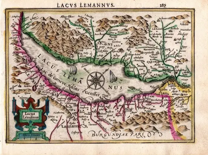
The lecture examines two millennia of mapping the lake, from the Tabula Peutingeriana to the 2014 multibeam sonar bathymetry. Gauthier investigates how place-names evolved, how the lake’s borders were drawn, why some old maps depict it ‘upside down’, and how cartography shaped local narratives.
In French.